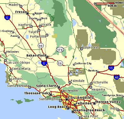
| Our square mile of land is located at the red "X" in the center of this map. The green blotch just above it is the southernmost section of Sequoia National Forest. |
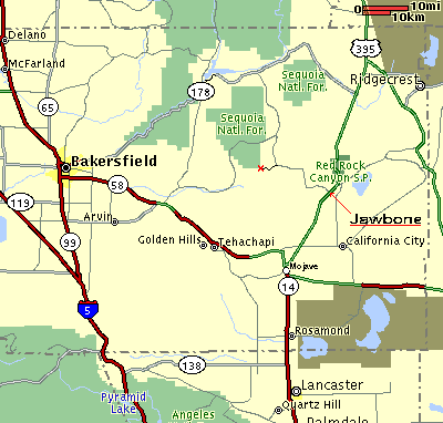
| From L.A. we take Highway 14 (the Antelope Freeway) to Mojave, then continue north on 395 for 20 miles to Jawbone Canyon Rd. Only the first mile or so of Jawbone is paved. The road is well maintained for 22 miles, up to the intersection with Kelso Valley Rd. (which goes north to Lake Isabella). The last 4.5 miles of Jawbone Canyon Rd. up to our land is usually bladed out just two times a year: before Memorial Day and Labor Day. A severe Winter makes Spring travel on this last section of road challenging. |
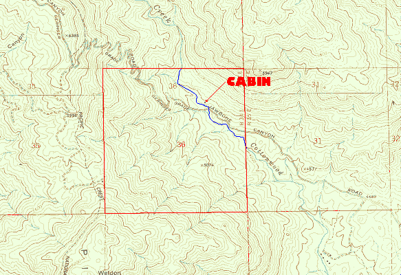
| The red square in the center of this map is our land (Section 36 of Township 29 South, Range 34 East). A sign marks its entry point along the road. Cottonwood Creek crosses the road just past the silver gate on the right that leads to our shared cabin (and the caretaker's cabin nearby). The switchbacks (called "Geringer Grade") lead to an entrance to Sequoia National Forest, which touches the Northwest corner of our land. Here's a map of who owns what: |
Sequoia Nat'l Forest |
Kelso Ranch |
B.L.M |
Privately Owned |
Our Land |
Kelso Ranch |
B.L.M. |
Kelso Ranch |
Privately Owned |